Recent searches
Search options

#mapstodon


Wonderful podcast episode with @bdon of @protomaps fame 
This conversation is awesome to get a better understanding of #Maps, the #OpenStreetMap data, running an open source project, and how it all comes together in #Protomaps and #Maplibre 
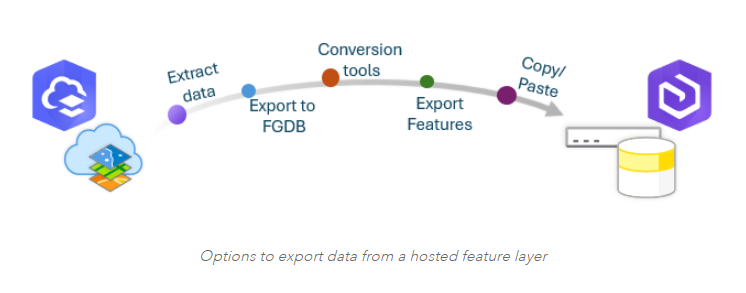
Guide to migrating #data from #ArcGISOnline to an enterprise #geodatabase https://tinyurl.com/2dv9n97t
#DataMgmt #featurelayer #ArcGISAdmin #GIO #GIS #esri #arcgis #GISchat #geospatial #mapstodon @esri @esrifederalgovt @esrislgov @arcgisonline @esritraining @urisa
How #Microsoft Users Can Seamlessly Unlock the #Where in #Data https://tinyurl.com/v2rebs7s via #ArcNews
#location #spatial #business #intelligence #geospatial #GIS #esri #arcgis #mapping #GISchat #mapstodon @esri @msftnews @esrifederalgovt @esrislgov @esritraining @urisa


Experimenting with showing custom icons for stations. Inspired a bit from our highway shield rendered (derived from OpenStreetMap Americana)
https://gitlab.gnome.org/GNOME/gnome-maps/-/tree/wip/mlundblad/station-icons
It's making use of the "network:wikidata" OSM tag.
Currently rendering these icons in map view itself is not tested (this needs an extra addition to our planetiler generator for the vector tiles to be run in the next import).
")


I ask this periodically, but: Has anyone made an updated version of this detailed 1970s-era USGS map that includes both Alaska and Hawaii in their correct position?
I own one (the USGS used to sell it — not sure if they still do), but I keep wondering if anyone has updated it. #Mapstodon

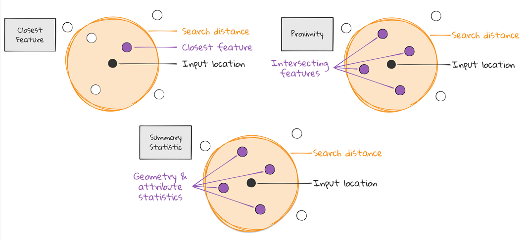
Near Me widget for #spatial #analysis in #ArcGIS Experience Builder https://tinyurl.com/vr6wfv5s
#location #intelligence #GIS #esri #mapping #GISchat #geospatial #ArcGISApps #mapstodon @esri @esrifederalgovt @esrislgov @arcgisapps @esritraining @urisa


Me acabo de enterar en plena migración a compose de mi app de rutas, que osmdroid ha sido descontinuado.
Es una pena porque era una libreria maravillosa para quitar a Google de en medio.
Conocéis alguna alternativa que tome el testigo?
 Do you know any viable alternative to osmdroid for map building in Android?
#FLOSS
#osmdroid
#AndroidDev
#Androiddevelopment
#androidapp
#googlemaps
#opensource
#mapstodon
#maps

5 Roseberry Topping, North Yorkshire UK
https://www.trailspotting.com/2025/03/roseberry-topping-north-yorkshire-uk.html
Hike this iconic & sweet-sounding peak in the Cleveland Hills, on the edge of the windswept North York Moors.
#Hiking #NorthYorkshire #Yorkshire #Nature #Outdoors #UK #Trails #Mapstodon #Summit

watching @nakaner 's talk on completing #OpenStreetMap tags like surface=* I'm thinking about more goal directed ways.
Idea for surface=* tags
1. Use a routing engine such as osrm, remove all surface tags from ways, and compute many alternative routes between cities on that
2. For all alternative routes make sure that the osm ways all have surface tags on them
This approach gives us a heuristic for prioritizing completing the map where it matters most.


Holy CRAP we shook our pants off when we saw this notification from our instance.
Especially after all the hastle to find a decent european server last year.
And then it hit: 1st april!
*nervously giggling while sipping coffee*
Jérémyyyyyyyyy!


Dear #mapstodon community, we are moving! 

We have made the difficult decision to move our account to another fediverse instance, in order to better comply with our data protection regulations.
But we do love this map-loving community and we hope not to loose any contacts!
If you want to stay in touch and keep seeing our posts, follow us here: @heigit@mastodon.social


Done mapping all 40 #barangays of Luna, La Union, #Philippines  in #OpenStreetMap, creating their #Wikidata items, and linking the two with each other.
A huge thanks to JR Dizon of the Luna Municipal Planning and Development Office for the boundary data. 
Wanna play around? Here is the Overpass Turbo query: https://overpass-turbo.eu/s/21s0
And here is the Wikidata Query Service (WDQS) query: https://w.wiki/DfYz
Previously: https://en.osm.town/@seav/114092122864097831

, and OpenStreetMap relation ID.")

In 1 week, @esri webinar: Enhance Your #Business Decisions with #ArcGIS for #Microsoft https://tinyurl.com/4ff7crha
#location #spatial #intelligence #geospatial #GIS #esri #mapping #GISchat #ArcGISApps #mapstodon @esrifederalgovt @esrislgov @esritraining @arcgisapps @urisa @msftnews

There has been some controversy around naming of certain bodies of water in other map apps lately.
So I thought about a possible solution to take a more neutral approach to this in Maps:
https://gitlab.gnome.org/GNOME/gnome-maps/-/commits/wip/mlundblad/golf-of-something


Love @fil’s idea of “slow cartography” when it comes to making maps and visualizations. Our digital tools certainly enable a lot of things that were extremely difficult or not possible with map making previously, but due to the pace and cost of industrialization it often means the quality or depth of the work is lacking or overlooking something of importance.
#maps #mapstodon #tech #geo #gis
https://observablehq.com/blog/maps-and-data-visualization-with-fil-riviere